Laguna de Peñalara in the Guadarrama National Park, Madrid

Peñalara circular route

Madrid

The summits of Madrid


This is one of the most famous hiking routes in Madrid. The 14 kilometre route leads you to discover the stunning landscape of lagoons and glacial formations in the Sierra de Guadarrama National Park. It also takes you to a unique viewpoint: the Peñalara Peak, the highest summit in the region.   There are many routes and paths you can take to discover the Sierra de Guadarrama National Park, its natural wealth and most iconic landmarks. The Peñalara circular route is one of the most popular routes with hikers. It covers the massif of the same name, which is known for its mountaineering tradition and for having the best glacial remains in the Sierra de Guadarrama. The path leads hikers to the main summit, the Peñalara Park, which is 2.428 metres high, and then continues its route among its lagoons. The circular route is 14 kilometres long, well sign-posted and has 650 metres of ascents and descents. A route of intermediate difficulty, as it is a high mountain route there are stretches of added difficulty where extra precautions need to be taken, particularly in winter.

The summits of the Peñalara massif

The route begins at the Peñalara Visitor centre, situated in Puerto de Cotos (Rascafría). The forest track starts to climb through the beautiful pine forest to the first stopping point: the Mirador de la Gitana viewpoint. Its fabulous views are just a taste of what awaits you farther on. The path carries on up to a small hut, at which point you have to veer to the left. The climb takes hikers on a zigzag route up to the first summit, Hermana Menor (2,271 metres high); the next part of the climb is more gentle and you soon reach the second summit, Hermana Mayor (2,280 metres high), which offers a great panoramic view of the following elevation: Peñalara Peak. A final effort is then needed to reach the target destination, but once there, it will certainly have been worth it.

Images of the Peñalara.route

Risco de los Claveles

After a well-earned rest, you will come to the most difficult part of the route; the Risco de los Claveles. There are some very narrow stretches on this part of the route, with a sheer drop at the sides, so we suggest that anyone who suffers from vertigo to keep to the left. However, those bold enough to persevere will be rewarded with a superb panoramic view of the Pinilla Reservoir. Once the tricky part of the route is completed, you begin your descent down the Risco de los Pájaros. The following few kilometres are for enjoying and relaxing, as the most stunning landscapes of the route await you.

The lagoons of Peñalara

The Laguna de los Pájaros beauty spot is the first of these. Following this are the Laguna de los Claveles and, farther on, the Cinco Lagunas. The path continues its descent and at one point there is a small detour towards the Laguna Grande de Peñalara; although it tends to be fairly busy, it is worth leaving the path to pay it a visit. Then, you come to the final stretch of the route, which once again takes you past the Mirador de la Gitana viewpoint, and back to the car park of the visitor centre along the initial forest path.

Laguna de Peñalara in the Guadarrama National Park, Madrid

Tips and recommendations

How to get there

The Peñalara Visitor centre is situated in Puerto de Cotos. To get there by road, you take the M-604 from Rascafría (about 16 km away), and from Puerto de Navacerrada (around 39 km away) take the SG-615. The visitor centre has a parking area, although it is recommended that you arrive early to get a space.You can also get to Puerto de Cotos by train, taking the suburban lines C-9 (Cercedilla-Cotos) and C-8, which connects Cercedilla with the railway stations of Atocha and Chamartín in Madrid. You can get there by bus from the capital, Madrid, on services that leave from the Moncloa and Plaza Castilla interchanges. Additionally, during the winter months, there is a shuttle bus service from Cercedilla to Puerto de Cotos, Navacerrada and Valdesquí station which operates at weekends and on public holidays.

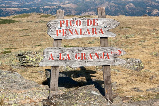
Poster Peñalara Peak in the Guadarrama National Park, Madrid

Things to bear in mind

For conservation reasons, a series of safety rules and limits on visitor numbers have been established for the Peñalara massif. All visitors must first go to the visitor centre to check the availability of places. It is recommended that you contact the centre prior to your visit to check. It is best to avoid weekends, which is when it is most busy, particularly from midday onwards. If it is not possible to do this, then it is a good idea to come for your walk early in the morning, avoiding the busiest times. This high mountain route can be done at any time of year, although it is always a good idea to check the weather forecast and get information from the visitor centre on route conditions and what you will need to take with you. Spring and autumn are the best seasons to do this route in. During the summer, water areas may be dry. On the other hand, at winter you need to take extra precautions and it is only recommended you do the route if you are an experienced mountaineer, as it requires knowledge and the use of specific materials (crampons, ice pick).  Don’t forget to take plenty of water, food and snacks (chocolate, nuts, fruit, etc.) to keep your energy levels up on the route. It is advisable to follow the signs and to wear appropriate footwear and clothing. Hat, sun cream and sun glasses are also essential items to have in your backpack.

Find out more about...
What to do

More things to see near here